Last Update: 22nd July 2019
This is the "Circles" Projects page for the Horspath Archaeology & History Group.
Circles Project
[Posted 12th June 2019]
During a survey of one of the tracks near the Old Horsepath site, some of the group members found a circle of dead grass. Using Google Earth to survey the area we found more cropmark circles (see image below) and we have an on-going project to work out what, if anything, these circles are.
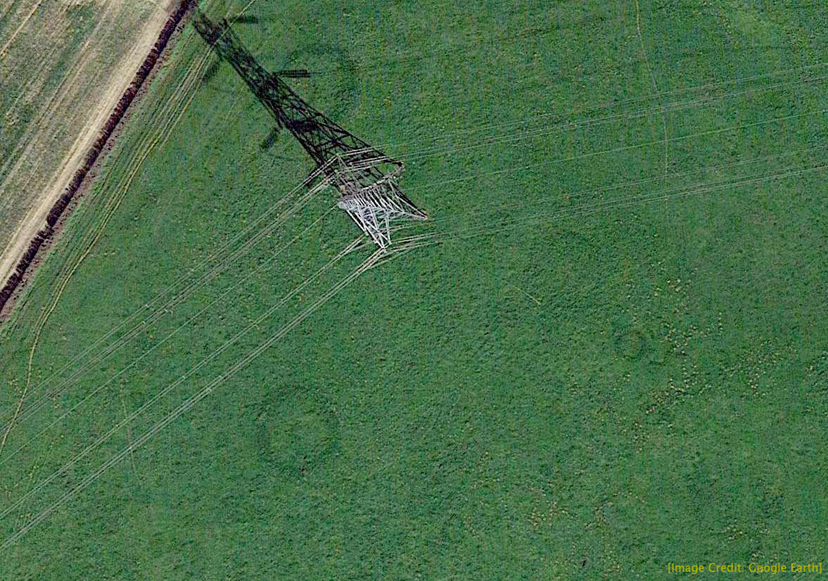
Pylon Field Circles
Image of our main circles near the pylon. Note the "dimple" at the centre of the lower circle, and ghost outlines of many other circles of various sizes.
These dimples are the cropmarks left by the original internment of the ashes of the dead incumbent, in a clay pot; probably a "beaker" of the Beaker People - one of the first farmers to come in to this country from the Iberian peninsula around 2,500 BC. The beakers have been shown to contain residues of an alcoholic drink made from honey.
Information about the Beaker People can be found at this link: Bronze Age Britain
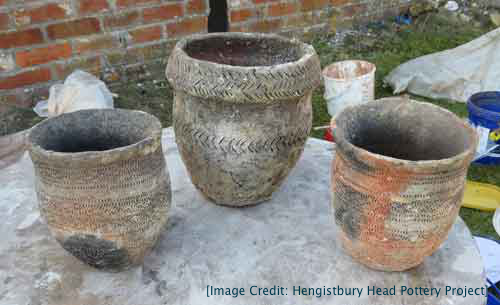
Modern copies of two Beaker pots and an Urn
We do have permission from the landowner (Denis Walker) to dig small trenches in the field as long as we back-fill them immediately after we've taken photographs and samples, to prevent his cattle injuring themselves.
Chris did some investigation of the circles before the rain set in and found no evidence of stone wall remains.
Some of the circles contain clumps of nettles which are always a good indicator of disturbed ground - or soil that is rich in phosphates from human activity like faeces or other biological waste products. In excavations, high phosphate areas with a zero phosphate inner area are often a clue to an ancient dwelling - the detritus being thrown out of the house.
We have a soil testing kit and intend to do some testing for phosphate levels within and around the circles once the weather improves.
Sally created a document from Ivan's Google Earth image showing the circles in relation to the pylon and attaching coordinates to each circle - see below.
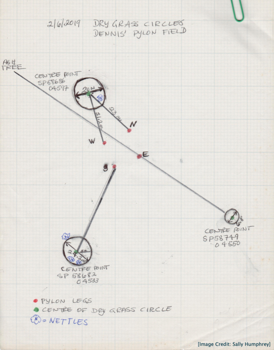
Sally's Document
Circles Project - Soil Testing
[Posted 30th June 2019]
On Friday 28th June, Chris and Geoff took soil samples from the circle to the south of the pylon. We took four samples, one outside the circle, one on the edge of the circle, one inside the circle and one in the centre of the circle (see numbered circles in the image). We removed a section of grass, then Chris used his 18-inch soil auger to drill down into the soil and we took samples from the soil at the bottom three inches of the auger and put them in labeled plastic bags.
Geoff used a Hanna HI3895 Quick Soil Test Kit to test the four samples for phosphate levels. The test is not very accurate and gives four indications of phosphorous levels using a colour scale: "trace", "low", "medium" and "high".
Results were as follows:
Sample #1 = "Trace", Sample #2 = "None", Sample #3 = "Trace", Sample #4 = "Low"
If we do any further phosphate testing we must take larger soil samples, at least a cup of soil instead of a few teaspoons. This will give slightly more accurate results.
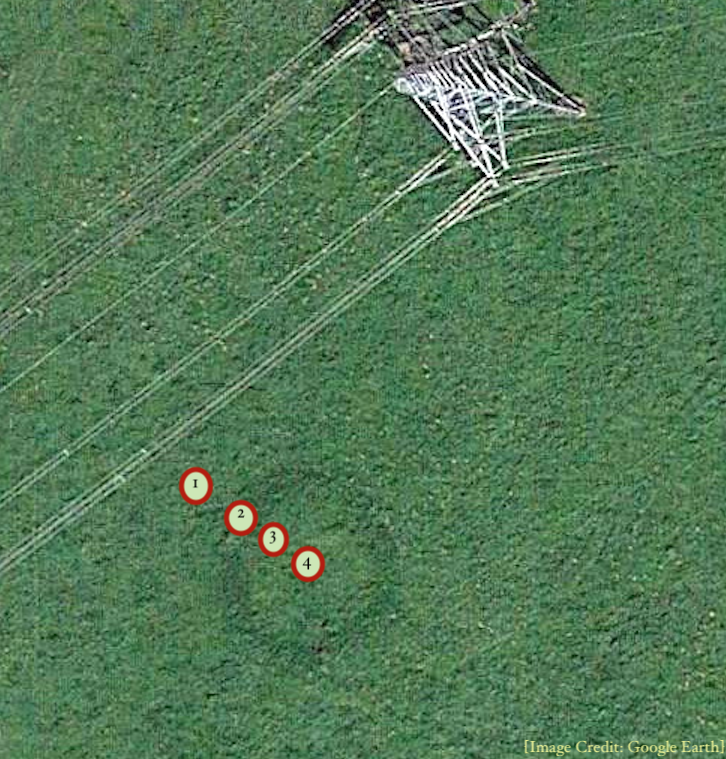
Soil test markers in Pylon Field Circle
The above image shows where we removed soil samples from the circle for phosphate testing.