Last Update: 1st November 2024
This is the "Slade Camp" Projects page for the Horspath Archaeology & History Group.
Under Construction!
Slade Camp Project
Many Horspath people enjoy walking in the vicinity of Brasenose Wood, a short distance by footpath to the west of our village - and discover strange tarmac roads and the bases of mysterious buildings...they are on the site of a world war two training camp! A substantial part of this camp was within the parish boundary of Horspath.
The wartime military camp known as Slade Camp was established in 1938-9 and opened in March 1940 for use by the Oxford & Bucks Light Infantry. The lands known as Wood Farm and Open Magdalen were leased by Richard Pether (William Morris's grandfather) from Magdalen College, and this land was sold to Lord Nuffield for £26,000 in 1934. The parish boundaries at that time meant that some 50% of the entire camp was within the parish of Horspath.
With the growing prospect of war in the late 1930s the Oxford & Bucks Light Infantry required additional facilities to their Barracks on Hollow Way, and this land was made available for the construction of a large hutted camp and training area. (It might be that Lord Nuffield actually gave this land for that purpose); he was known for his connections with Lord Beaverbrook in the context of offering the Morris factory for aircraft repair work and Tiger Moth production even before war broke out.
Once the huts, garages, workshops, roads and other infrastructure were established, the camp was opened in March 1940, as No. 15 Infantry Training Unit, and early on some 1,500 soldiers were in occupation. The Ox & Bucks initially occupied the camp, and it was also used throughout the war by other military units such as the A.T.S. and Home Guard. In 1945 with victory on the horizon the government turned its attention to the problem of efficiently discharging thousands of military personnel once peace had been won.
Thus the camp was turned over to the enormous task of demobilising thousands of troops returning to the U.K. from abroad. Redesignated No. 2 Military Disembarkation Camp Unit (one of six such camps), all Southern Command soldiers began to arrive at Slade Camp to prepare for leaving the armed forces and returning to civilian life. This involved being given a grant of money, shirts, underclothes, a raincoat and hat, shoes - and the famous "demob" suit! Thus equipped, all moved on to No. 6 Military Dispersal Unit at Taunton and thence to civilian life.
But this was by no means the end for Slade Camp, and it quickly assumed a completely different function in early postwar Britain - ready-made, if albeit temporary, housing. Camps like this were used everywhere to house the thousands who had been displaced, evacuated or simply bombed out, until the planned council house building and estate programmes were completed in the 1950s. The many huts lining the roads - such as Fourth Avenue & Ninth Avenue, were converted to family housing, and many of those who lived there in the rural peace by Brasenose and Magdalen Woods described it as "the best time of their lives"!
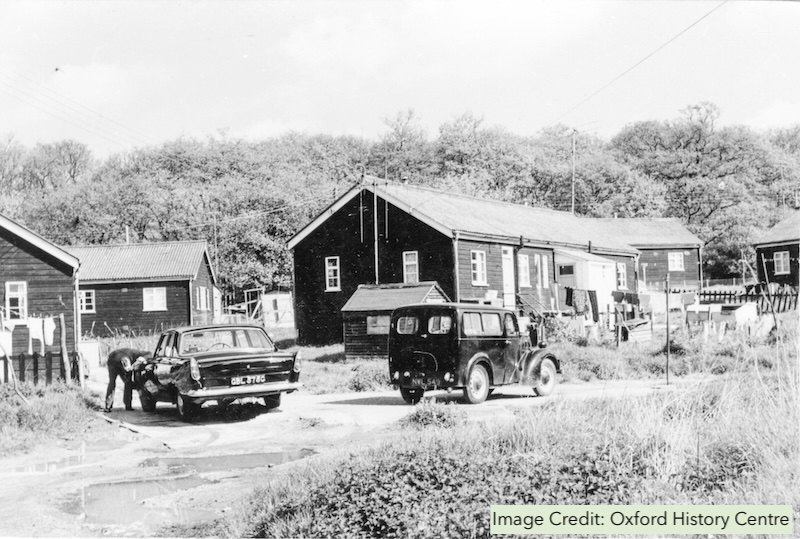
4th Avenue South.
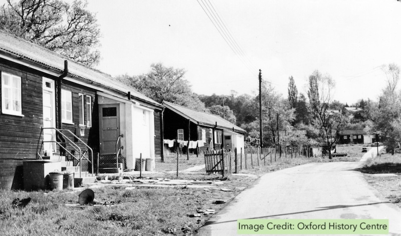
4th Avenue North-east.
The first family moved in in November, 1948, and Slade Camp was thus occupied until the demolition of the huts began from 1961; but with the massive disruption of the Eastern Bypass construction in 1959 which sliced the camp in two, families began to leave for the new estates such as nearby Blackbird Leys; but the very last to go were around 1970. The Kelly's Directory for 1969 lists no less than 80 families still in residence.
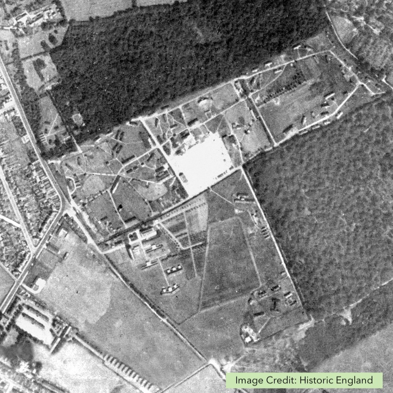
Slade Camp, 1943. This image shows all of the camp - the straight path going north with Brasenose Wood on the right is "Ninth Avenue", which marks the Horspath parish boundary, and extends to Magdalen Wood at the top. Here the boundary goes east to The Ridings, and follows the path at top right of the image - all the huts in the north-east section were in Horspath.
It is still possible to walk around the eastern side of the camp using the wartime roads which were laid down, and in many places can be seen the brick and concrete foundations of several buildings, but much of what was an open area is now covered by undergrowth, bushes and trees. At the eastern end of The Ridings there still remains a crude wartime "Norcon" pillbox, cut from a concrete sewer pipe and furnished with rifle apertures... but on the opposite (western) side of the bypass, nearly all the site has been covered by new housing, yet today a very few of the wartime buildings remain occupied.
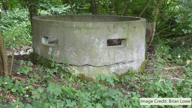
A "Norcon" pillbox at the eastern end of The Ridings, appears to be smiling!
The Shotover Preservation Society has been doing some work in the camp and recently uncovered a large base of the Officer's Hut.
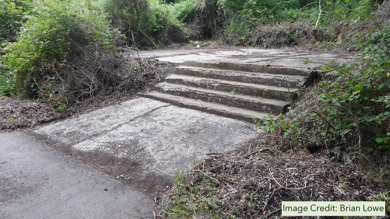
The large base of the Officer's Hut recently uncovered, in the north-east area of Slade Camp.
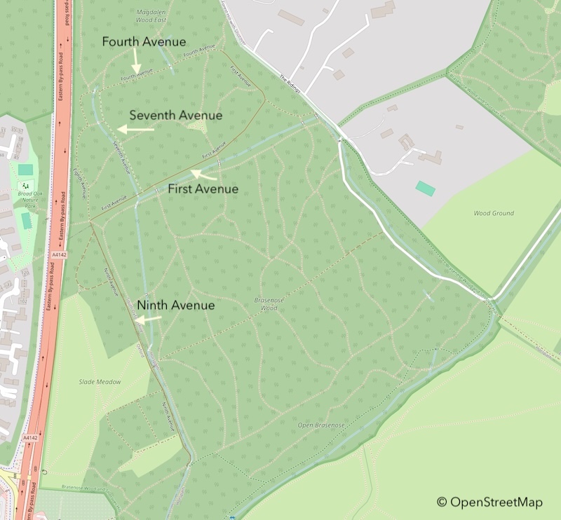
This map from the OpenStreetMap project shows the avenues in Slade Camp and the Eastern Bypass. A larger, easier-to-read version of the map will be found here: Open Street Map
Useful Links
This section contains some links to information about Slade Camp from the internet. These links were active/valid in October 2024 - please inform us if you find that they no longer work.
Trevor Joseph and Slade Camp. Trevor Joseph lived in Fourth Avenue with his family and this site documents his exploration of his past. It has some wonderful pictures and descriptions of the area and well worth a read: Trevor Joseph
The Headington History website contains much useful information about Slade Camp: Headington History
The Shotover Preservation Society has an article about Slade Camp here: Shotover Preservation Society