Last Update: 14th March 2022
This page contains reports concerning group activities.
A Romano-British Pottery Kiln on Shotover
[14 March 2022]
In June 1973, the ploughman for Manor Farm - John Heritage - contacted Chris Pym to say that in ploughing The Row (a field on top of Shotover, which contains the reservoir) his plough had hit a substantial underground obstacle that had broken its shear-link, much to his annoyance. Knowing of Chris’s interest in that field due to its widespread Romano-British pottery debris, he decided to identify the spot with a view to try and establish exactly what that obstacle was.
Chris arranged to meet John on site to do some exploratory work. He quickly discovered the top of a Romano-British (RB) kiln and over the next few weeks managed to carefully excavate it, recording all finds as he went. Photographs of the excavation are below:
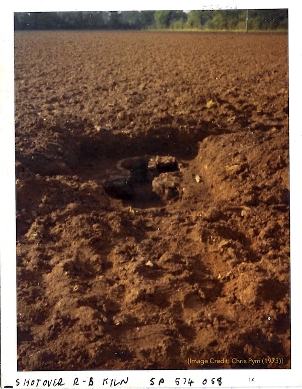
Initial Dig Site
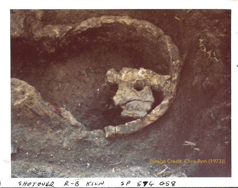
Exposed Kiln
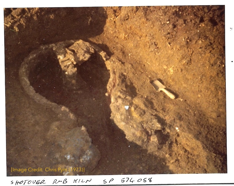
Exposed Kiln
A Roman-British up-draught kiln like this comprises:
- Stokehole pit
A large hollow dug below ground level in which the fire is started, and into which the ash can be raked - Fire-box
A flue or fire tunnel leading from the stokehole to the furnace - Furnace
The combustion-chamber, beneath the oven in which the pots are to be fired - Oven
The firing chamber in which the pots are fired. A temporary domed structure formed of turfs, straw and clay, built up on a framework around the pots as they were stacked, and removed when the firing is completed. The pots rest on a series of clay firebars or, as in this case, a vented floor to allow the hot gases to circulate around the pots.
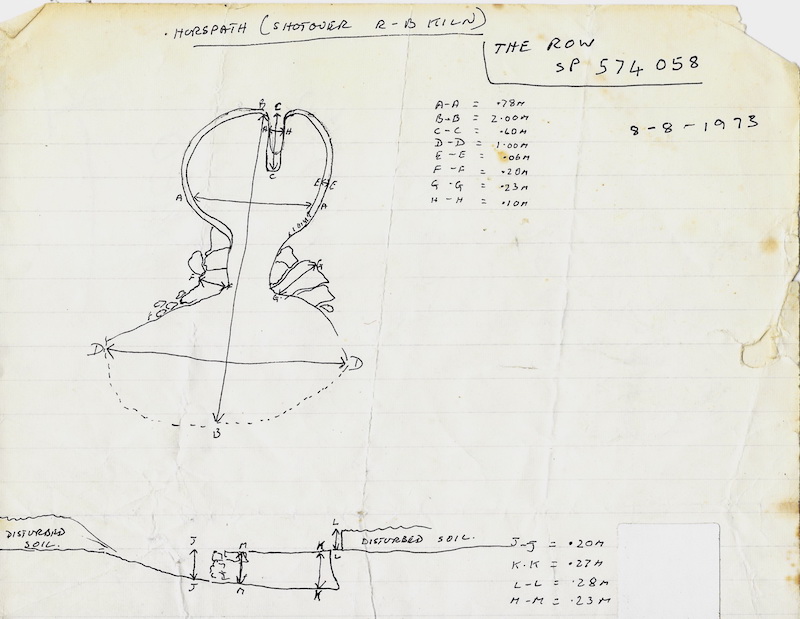
Kiln Overview
One of the more interesting finds was the base pivot of a potter’s wheel, made from what looks like Yorkshire Grit. The first example found so far in Britain according to Chris Young, who mentions it in his monograph, “The Romano-British Industry of the Oxford Region” (BAR Report No 43), reprinted with additional material in 2000.
Another curiosity was the discovery of a sheep’s leg bone resting at the kiln’s stoke-hole entrance where, presumably, it had been cooked and the residue thrown into the hole after eating. A lovely human detail of those old potters’ activities and eating habits some 1,700 years ago!
It seems that the kiln was never re-used subsequently as the small amount of pottery recovered during the dig argues that the kiln had been mostly cleared after that last firing. Only one fragment of the kiln’s floor had survived the plough and no further pieces of it were in evidence.
The Row field, and the adjoining allotment fields on the Wheatley side, have long been known for their extensive Roman pottery debris (mostly comprised of “wasters” - badly fired and rejected pots).
From the Row area alone, over twenty localised areas of waster material were counted, and there will have been many more originally.
For a modern comprehensive survey of the East Oxford Industry and it’s place in the landscape, see:
Roman Oxfordshire - Paul Booth
Note: The kiln is still in situ on The Row; the contents went to the Oxfordshire Museum.
SPF Site Dig Report
[25 September 2021]
On Saturday, 25th September 2021, Simon Underdown, Jemma Underdown, Sally Humphrey and Geoff Roynon joined forces to dig a test pit on the edge of a grass circle on the “SPF” site. Chris Pym and Mary de Jong also joined us to help with digging and expertise.
Using Google Earth and field walking, we had found two large grass circles on the site, each about 20-26 metres in diameter and which could be the remains of bronze age barrows. A third much fainter circle was found nearby and appears to be related to the other two circles being roughly the same diameter (20 metres). See diagram at end of this report.
We decided to put a test pit across the edge of Circle 2 to hopefully find some construction details and dateable material.
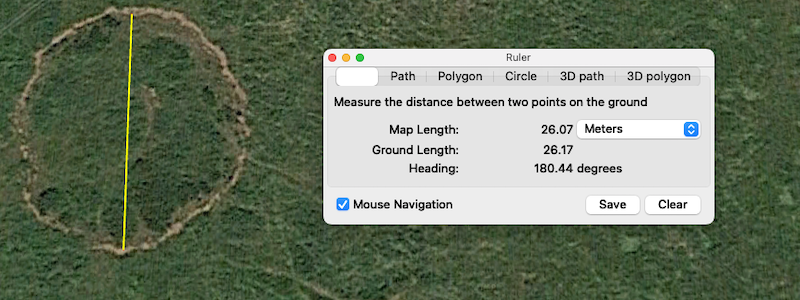
Circle 2 Google Earth Measure
A one metre square area was marked out and the top layer of grass removed. The ground was very hard and difficult to dig so it was decided to work on one edge of the test pit only.
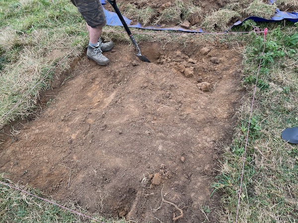
Start of dig - grass layer removed
Near the top of the dig we found various bits of old clay pipes and lots of ironstone.
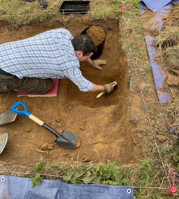
Simon hard at work
Further down in the dig we found the remains of some ancient pottery which was too delicate to remove intact.
We also found bits of charcoal which we may be able to use to date the different layers.
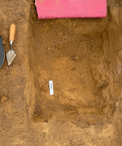
Ancient pottery remains
The pottery remains are to the left of the white ruler and broke up when removed.
We finally found the edge of a ditch which follows the curve of the circle.
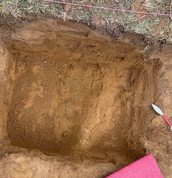
Edge of ditch
Before filling in the dig, we left a dig marker in the ditch in case someone else digs there in the future.
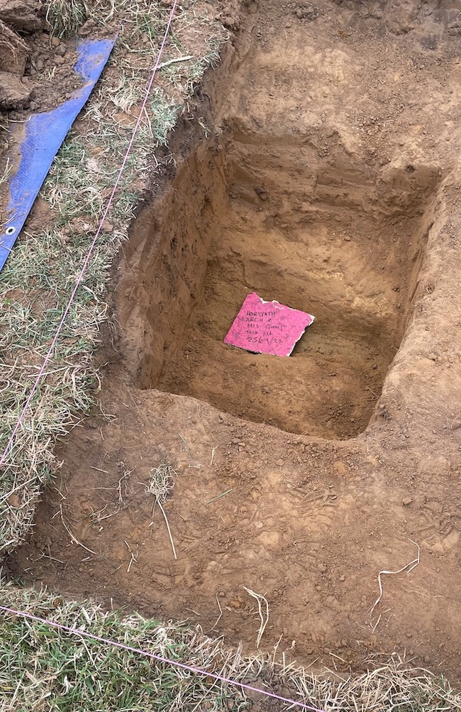
Dig Marker
At the end of the dig we refilled the trench and cleaned up the site.
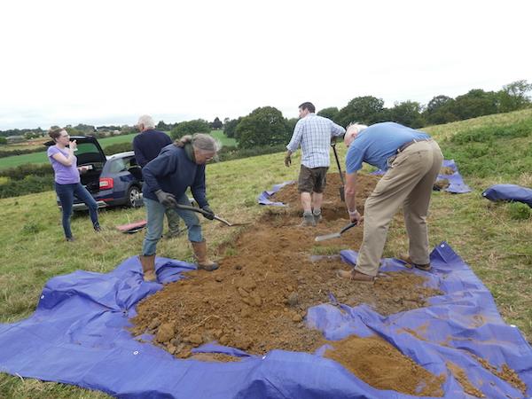
Clearing Up
We also found a piece of white limestone which may have been used to decorate the edge of the ditch when it was first constructed.
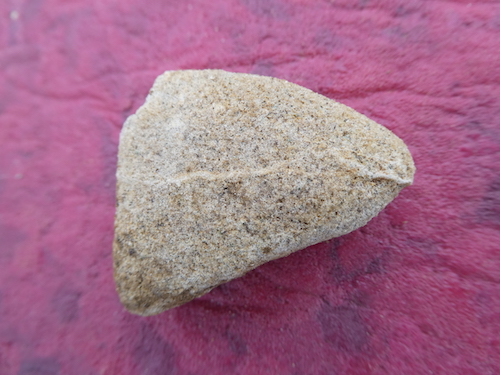
Limestone piece
The following rough diagram shows the three large circles in the SPF field - not to scale!
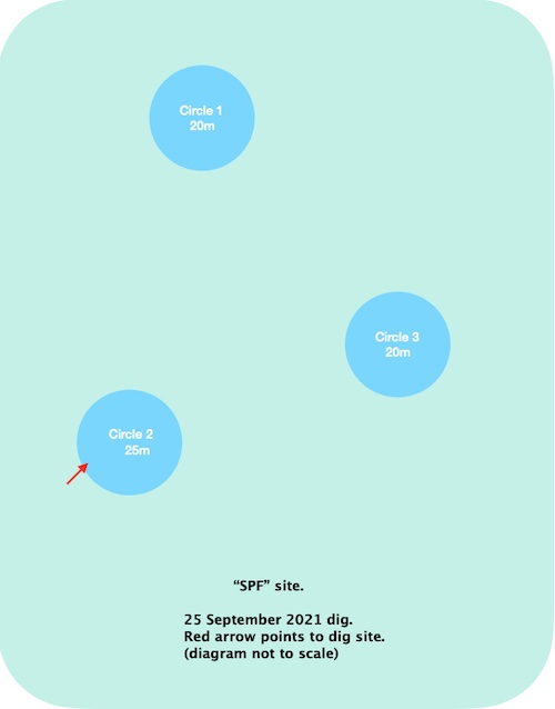
SPF Circles diagram
Garsington Ridgeway Report
[Posted 18th June 2019]
Recently, one of the group (Geoff), while exploring the Garsington ridgeway area using Google Earth found what looks like a probable bronze age barrow. Chris did some more exploration around this area and found three more possible barrows in adjacent fields.
This needs further investigation on the ground but needs to be cleared with the landowner first.
Note that these barrows are on private farmland not open to the public and the cropmarks only appear very rarely when soil conditions are suitable.
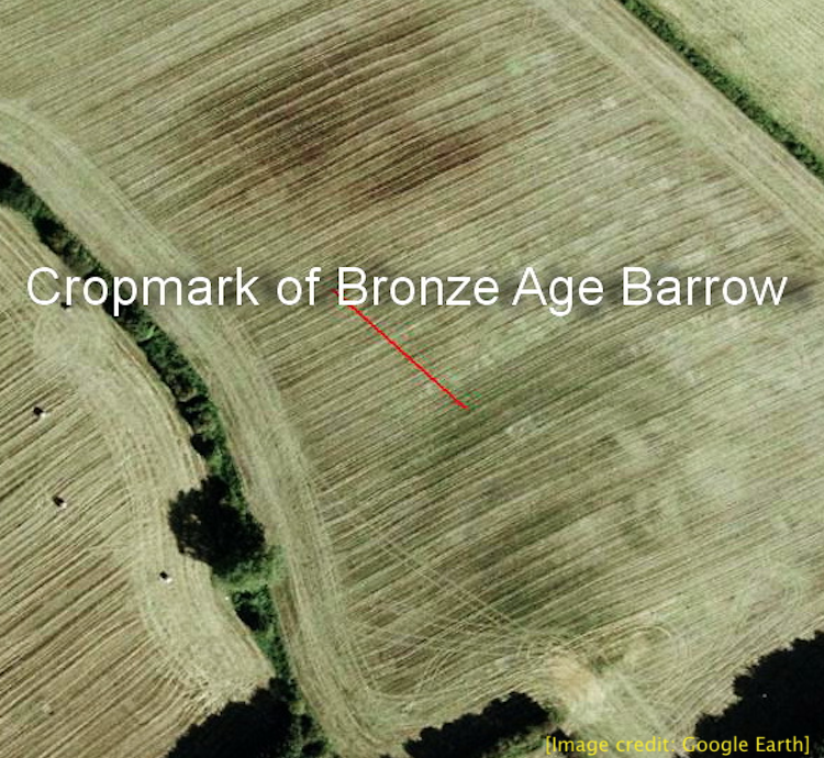
Bronze Age Barrow (Google Earth 2004 image)
An image of the same barrow from Google Earth taken in 2014.
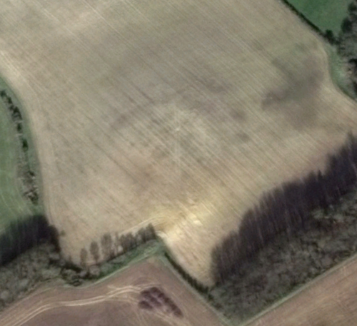
Bronze Age Barrow (Google Earth 2014 image)
Windmill Lane Report
[Posted 4th July 2019]
Chris found some interesting circles on a field near Windmill Lane while browsing Google Earth.
"There are some curious cropmarks in the small angular section of this field that look remarkably like an Iron Age (?) settlement.
The larger circles being huts & the smaller ones storage pits. I did do some test pits here forty years ago because of the curious deviation
on the old lane at that point, but found nothing.
However, given this possible new evidence I think it's time for another try - precisely where the larger circles are close to the hedge -
as we can focus more clearly at those points. As this location is directly above the Dam area mentioned in the OH paper it may be of significance."
The images below are from Google Earth taken in 2004 and 2017
This needs further investigation on the ground - the landowner is Denis Walker.
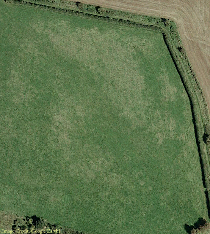
Circles in field near Windmill Lane (2004)
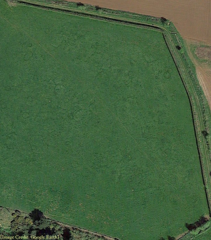
Circles in field near Windmill Lane (2017)
Windmill Lane Test Dig Report
[Posted 19th July 2019]
Chris revisited the Google Earth images of the Windmill Lane field and used the Google Earth tools to measure one of the more distinct circles. The image below shows the circle which is 40 feet from the top right corner and 26 feet in from the hedge.
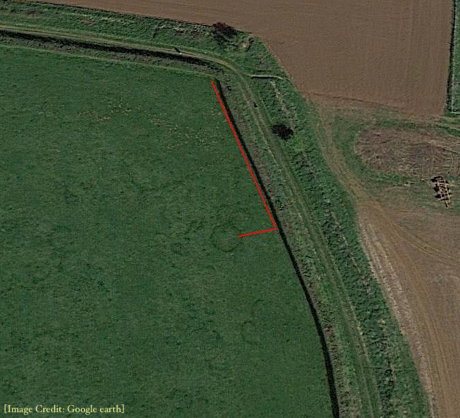
Measurement of circle in Windmill field
Chris and Geoff visited the field on the 18th July 2019 and measured 40 feet from the top corner and 26 feet in from the hedge.
Using a pickaxe and shovel we started digging a small test pit. About 6-8 inches below the surface we started finding many small rocks and stones, mainly
ironstone. Digging was difficult because of the quantity of stones we had to remove. Chris used his 18-inch soil auger close to the test pit and hit more
stones. However, when he tried 2 feet nearer the hedge and two feet towards the centre of the circle the auger had no problems going down 18 inches.
We need to run a trench across the edge of the circle and see if the stones/rocks form part of a collapsed wall.
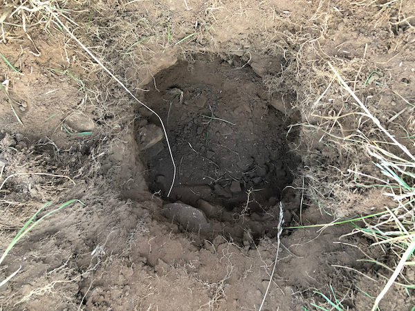
Test pit with many large stones